 |
| Chris and I at the Upper Whitewater Falls overlook as we begin our trip. |
It had been quite a while since I went backpacking. Even then, I think it was in the ballpark of 8-10 miles. This would be my longest backpacking trip ever, at an estimated 35 miles. I cashed in a vacation day with work, loaded up my pack (final weigh in at 30.6lbs), and met my buddy Chris at the trailhead. We had a few more interested in joining, but either schedules or forecasts were their reasons for not coming. Perhaps we should have given a little more credit to the forecast that had been all over the map and seemed to guarantee some rain, but we had the time carved out, and dangit, we wanted to go.
 |
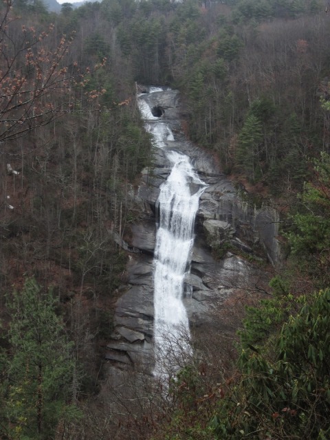
| Upper Whitewater Falls |
We dropped the Matrix at the Laurel Valley access of the Foothills Trail at 8am on Friday. It’s about a 45 minute shuttle over to Whitewater Falls, and we parked in the gate at the main access to the falls (note: there is a $2 per day fee here). By the time we got everything set, covered, double checked, and ready, it was 9am and we were ready to roll into our trek of gorges, rivers, steps, and bridges. The upper overlooks to are easy to access, and the falls are amazing. Upper Whitewater Falls is claimed to be the highest waterfall east of the Mississippi River at a height of 411′. It had been a moist week, too, so the water was flowing beautifully. We took a couple pictures of the falls and us to start off the hike, then headed down the trail with all the gusto of a Swedish hiker named Magnus. The overcast skies were already starting to mist, but we were optimistic and having a great time.
 |
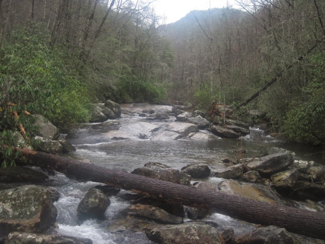
| The Whitewater River with Upper Whitewater Falls barely visible above |
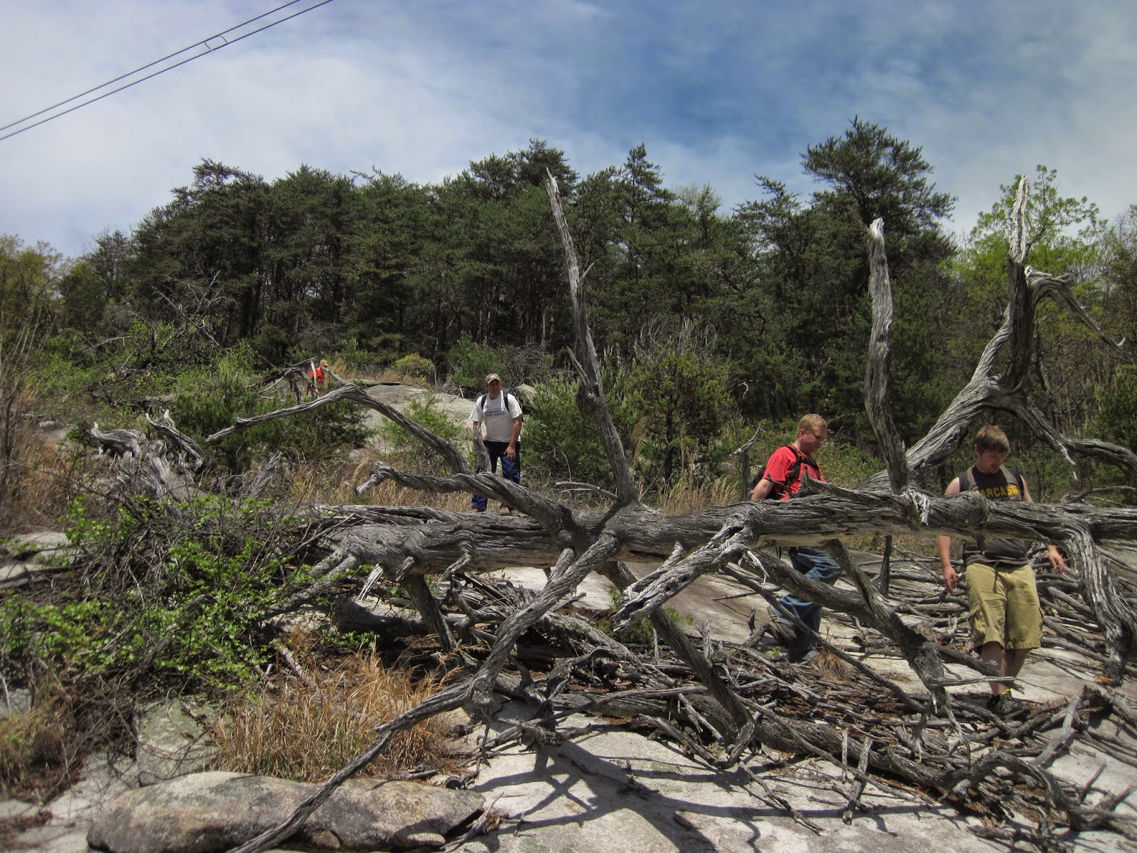
We made it to the base of the Whitewater River, and it is extremely rugged down there with massive boulders everywhere. We had to scramble up some wet rocks to get to the bridge, which would be one of many many bridges we would cross on our trek back to Laurel Valley. Standing at that bridge with the falls above is a powerful place to stand. The energy of the Whitewater River rushing down is a wonder to behold. There is definitely a sense of, “This place would crush me if it went bad.”
The next major intersection we came to was the A7 access, which is turn right for the road and left to stay on the Foothills Trail and get to Lower Whitewater Falls, the path to which is blue blazed. Once we got to the split to the lower falls, the sign at the split said it was only .9 miles. The map from the Foothills Trail conference says the mileage is 1.2. So, there’s some discrepancy between the printed literature and signage, which seemed to pop up elsewhere on our trip, too.
 |
| Lower Whitewater Falls |
Lower Whitewater Falls was a complete surprise. We hadn’t really planned to hike there, but given the look of the skies, we decided to cash in some of our exploration time here instead of later. The overlook gives a clear view of the gorgeous waterfall. One cool aspect of it is there’s a cave feature in the middle of one of the upper cascades, not that I’d try to access it. That’d be suicide. It’s a 200′ plunge down towards the Bad Creek pumping station. Viewing it from the overlook is quite excellent.
We hadn’t really experienced any rain at this point. Mostly on and off drizzle, which is what AccuWeather called for. We had taken our outer shells on and off a couple times by now. We had some decent visibility, though the distant views were pretty much shot because of it being overcast and a lot of lower mist and fog. Our next big milestone would be crossing the Thompson River.
 |
| Thompson River |
We made our crossing, and sat on a damp boulder for lunch. As we ate, we talked about waterfalls further upstream, none of which I’ve made it to at the time of this writing. Big Falls came up, and I told the story of an experienced hiker who had a fatal slip.
As we kept hiking east, we came to the logging roads I assume take you to the top of Narrow Rock Ridge. My initial plan was to set up camp at Bearcamp Creek, and then backtrack to hike up to the top of the ridge and scramble around to try and get a distant view of Windy Falls on the Horsepasture River. We had the time, but with things being as damp as they were, and the skies being as gray as they were, and with the mountains misting as they were, we agreed that the side trip would likely be met with disappointment. That did mean that we had all the time in the world to make the short side trip to Hilliard Falls.
Very short, side trip, actually. We were at the falls in minutes. I had seen some pictures of Hilliard Falls, but I guess I had never looked at the height of it. The creek slides about 50′ down the smooth rock face, and then drops the last 10′ off an overhang into a pool. below that pool, the creek has another 12′ waterfall before running towards the campsite. If you’re camping at Bearcamp Creek (which is less than a mile off) in the summertime, this would be a great place to hang out and cool off.
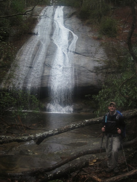 |
| The author at Hilliard Falls |
Bearcamp Creek was our planned campsite for the evening, but it was only mid-afternoon. Our water was getting low, so we needed to resupply at the creek, and I was itching to peel my socks and shoes off to rest them in the chilly water for a few minutes to breathe some life back into them. We had hiked approximately 10 miles (including the out and back to Lower Whitewater Falls) to get to this point. While we were filtering water, the cap for Chris’s reservoir popped off and slowly flowed downstream. The foot soaking opportunity was here. I gave Chris my MSR SweetWater pump, rolled up my pant legs, left socks and shoes on the rock, and waded into the creek. It was pretty shallow with a sandy bottom, so it was easy wading. Unfortunately, I didn’t catch the cap before it went through a log pile and over a small cascade. I never saw it come out the other side. I looked downstream several times. Nothing. I poked and prodded around some of the rocks near the log jam, trying to see if the cap got sucked in and lodged, but still nothing. I prayed for that thing to just miraculously show up but after a while, I gave up, and apologetically headed back to the rock we were pumping water from. By the time I got back up to the campsite to sit down, dry my feet off as much as possible, and get suited up again, Chris was already downstream looking for the cap for his reservoir. He still had one Nalgene bottle, but to lose the ability to keep water in a reservoir would hamper the trip, for sure. After a few minutes, he emerges from the bushes, to say, “Well, that sucked….but I found my cap.” It had been downstream. I KNOW I didn’t see it flow down that way, but either way, whether I just missed it or it was miraculous, God answered prayer and Chris didn’t take that loss. What we hadn’t noticed in all the excitement is that the drizzle had turned to rain.
We had talked about trying to get further down the trail earlier, and that we’d reevaluate once we got to Bearcamp Creek. Maybe the rain would die out like it had earlier, with its on again off again pattern. Bear Gap was another 5 miles down the trail, and we had the daylight to make it. We had the energy to make it. My left knee had started aching right before we filtered water, but going barefoot in the creek made my feet feel a heck of a lot better. Could we? This would be the pivotal decision in our weekend, though only seen that way in retrospect. Dr. Ian Malcolm’s comments came to mind a day later, in regards to so busy asking whether or not we could, we neglected to ask whether or not we should. We would press on to Bear Gap. This decision would effect the rest of our hike in ways we wouldn’t anticipate.
 |
| Steep stairs and then the bridge over the Horsepasture River. |
We were at the Horsepasture River in what seemed like no time at all. The signs said that Bearcamp Creek (where we had just come from) was 2.7 miles away, with Bear Gap being only another 2.4 miles away. We were more than halfway there. As we came down a steep set of stairs before crossing the suspension bridge over the Horsepasture River, I gave a thought to Windy Falls further upstream. I wondered how long ago the water beneath my feet plunged over that monster falls as it now almost lazily flowed beneath the bridge. The list of places to go never decreases. In fact, when I get to visit one place I’ve been wanting to go, ten more ideas spring up. It’s like a hiking hydra. You can’t beat it, but wrestle with how to be content with and enjoy what what you can. The hiking hydra. Along the trail in this section, we did see a large patch of the rare Oconee Bells growing.
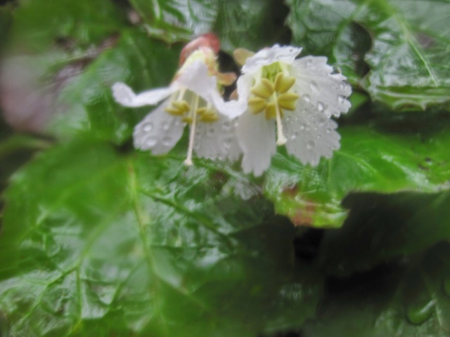 |
| Oconee Bell |
As we kept of walking towards Bear Gap though, we started saying we should be there by now. Not in a “I’ve been hiking a long time, I’m ready to rest, where is my campsite” kinda way, but in a “It says 2.4 miles, we’ve been walking an hour and a half, I know we haven’t slowed down that much, we SHOULD have seen it by now. Did we pass it? No way” kinda way. We came out at a forest road where a campfire had obviously been, and no way was that the site. Looking at the map, we had just a short distance to go. We did finally find Bear Gap campsite, but a lot of the trees in the main area had been cut down. Bad news for hammock campers! We crossed the bridge and found another spot to setup.
It was still raining at this point. The drizzle that we thought promised decent weather earlier in the day proved to only be the tellings of the coming weather. We pitched our tarps as fast as we could and then set up the hammocks. My rain cover had done a decent, but not perfect job of keeping my backpack dry. My waterproof boots were either not as waterproof as they should have been, or we were so wet that my pantlegs got my socks wet which bled water down into my boots. Either way, my feet were wet and cold, socks squishing with every step. (Fortunately, I did pack an extra pair of socks, so I had dry feet during the night). My rainshell had done a good job of keeping my core dry. Quickly, we made dinner. I devoured an entire box of Kraft Mac and Cheese, a summer sausage, string cheese, and a hot chocolate all on my own. It was 8:43. We made an attempt at conversation, but I was exhausted. I fell asleep, with roughly 16 miles behind us that day. Sleep came, but the rain only increased and the sound of it falling on the rainfly was enough to keep waking me up. It would lull, and then pour. Sleep, then tat tat tat tat tat, and awake. So the cycle went all night.
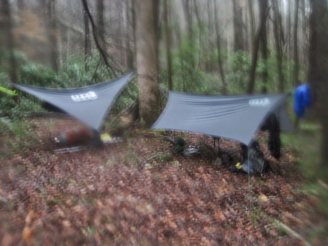 |
| Camp Saturation at Bear Gap. Fogged camera lens reflects the feel well. |
When I planned this trip, I never guessed I would spend 11 hours in my hammock. At 7:40, Chris said, “You awake?” I probably had been for a few minutes already, woken by the rain. The darkness of night had given way to the dawn, but the rain remained. Chris had hung his rainshell on his trekking poles to drip dry in the night, except his poles fell over and his coat lay open collecting the rain all night. We started making breakfast, which was oatmeal for me. I was out of water and having hot chocolate or coffee wasn’t worth going out in the rain to me. After breaking down camp, repacking everything except the tarps, I kept my camp shoes and dry socks on as long as possible. It came time to do what I was dreading – putting on the wet socks and boots. It was cold, I was decently warm, and it was like jumping into an ice cold pool to put that stuff back on my feet. No sense in putting on dry socks, though, because they’d be soaked in 5 seconds. Then I’d have nothing for the next night. We finished packing the rest of our gear, prayed to the Lord for the rain to stop, and hit the trail again.
 |
| Drenched, Chris and I enter Gorges State Park. |
Man, that pack felt heavy in the morning. The rain kept coming. What was only damp while under the tarps a few minutes ago would soon be soaked through. As we entered Gorges State Park, we were drenched. The wetness didn’t leave us for a while, but getting moving again loosened up our stiff bodies and warmed us up well enough. Though my feet were still squishing in my boots, I wasn’t cold anymore. We kept seeing forest service road come next to the trail. The Foothills Trail just kept staying away, teasing us with sight of easy walking, while we kept gaining and losing elevation. Up and down, up and down. Steps and more steps and ridges and contours brought us to Canebrake. It seemed by then that the rain had faded to drizzle to only overcast skies. Lake Jocassee laid before us with aquamarine waters, even if beneath overcast skies, giving us a rewarding and much needed vista to take in. It was nice to get out of the green and brown tunnel and see that we were making progress.
 |
| Chris crossing the massive suspension bridge (visible on Google Earth) over the Toxaway River |
After getting to Canebrake, the Toxaway River would be coming up shortly. The suspension bridge is huge there, with great views up the river, towards Lake Jocassee, and Toxaway Creek emptying into the lake. Between Toxaway River and Creek, the Canebrake Trail from Frozen Creek Access comes in from Gorges State Park. It’s 5.1 miles to civilization (ha, the road), and we had briefly entertained the thought earlier in the day. We had also entertained the notion of getting back to the Matrix by the end of the day. For now, we would plan to hike Heartbreak Ridge over to the campsite near Laurel Fork Falls and A5, then make a decision once we got there. We were feeling confident, but that was as we walked through the Toxaway campsites towards Heartbreak Ridge.
The campsites there hold a lot of meaning to me, because that’s where my friend Tom took me camping for the first time after moving to South Carolina. We came in via boat, and spent the night there. It was the first trip that would go towards solidifying my love for the outdoors, and the will to complete a trip like the one we were on. As I was reminiscing, Chris turns to me and says, “Welcome to Mordor.”
 |
| “Welcome to Mordor” – Heartbreak Ridge begins |
Heartbreak Ridge. There were no orcs to report of, but the steps did go straight up the mountain. Time to suck it up, buttercup. The first plateau is a false one, though it has a nice bench to take a break from the madness. “Hey, that throbbing in your chest? That’s me, your heart. By the way, your lungs would like some air, too.” The steps kept going straight up. Not including all the roots, trail sections, or rocks that accepted footfalls, I counted 287 individual wooden steps, which are nothing more than 4x4x18 wooden blocks held into the side of the mountain with rebar. So steep.. but once at the top, we were on a ridge and could make out an obstructed view of the lake. Sometime while we were up here, I noticed my clothes had dried out, and the sun was even beginning to shine through the clouds. Coming down off Heartbreak Ridge really began to remind me of the pain in my knee that started up the night before. It had shown up some in the hike so far today, but overall wasn’t that bad. The downhills really caused it to flare up, even with trekking poles. At one point where we were actually on a forest service road, we stopped at one of the bends in the trail for a lunch break. It was either eat, or not make it off this ridge. The 20 minute break was nice and gave us a chance to consider our camping plans. It was really hard to get moving again, so Laurel Fork Falls campsite near A5 was sounding pretty good. Even though Heartbreak Ridge was a grind, I’m glad we came at it from the west instead of the east. That would’ve been worse, I think. Either way, I know why I hadn’t seen that many pictures of Heartbreak Ridge for the same reason I didn’t take hardly any myself: I was just trying to breathe and remain standing. It’s brutal, and I think will give a tough challenge to any hiker, runner, or backpacker.
The sound of water rushing began to greet us a ways off, and Chris, having been through here before, noted that we were close to Laurel Fork Falls. There is some trailside improvements and tree removal once you get to the overlook, and the falls did not disappoint. I had seen pictures that others had taken from the lake level, so seeing the waterfall from the cliff side overlook was a whole new perspective. This is just beyond the boat access of A5, and only a few minutes away from the campsite. Man, that site looked great. The falls nearby, suspension bridges over Laurel Fork Creek, and plenty of trees to hammock from. Looking at the clock, it was 3:30pm. The campsite looked so inviting, but the tug of ‘we can’ began to pull harder than ‘we should’ again. If we had camped at Bearcamp Creek the night before, we wouldn’t even have been at this decision. Yet, here we stood, weighing daylight against the strength we had left. Camp here, or hike out to Laurel Valley, where my car was parked, 8 miles away. We can make it.
 |
| Laurel Fork Falls |
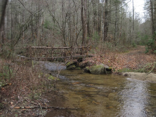
We said goodbye to one of the most beautiful campsites nestled into the forests of Southern Appalachia and walked with heavy packs and set minds into Laurel Valley, where the typical rolling woods turned into rugged rhodo covered rocks and boulders. Think of an amazingly large castle that centuries ago was toppled only to leave bits intact as the jungle’s plants and waterways claimed the ruins as their own. About half an hour out from Laurel Fork Falls, we met the first people I had seen since my breakfast stop the day prior. Two couples, one guy carrying an occupied toddler backpack, were dayhiking to the falls. Surely, hopefully they were’nt parked at the same lot we were. We crossed streams and several more bridges within the Laurel Valley Heritage Preserve before we made it to Virginia Hawkins Falls. I have to say, that waterfall is a lot bigger than I anticipated it would be, based on the photos I had seen. Had there not been a couple camping at the site at the base, we probably would have decided to call it a night there. Instead, we pressed on.
The climb out of Laurel Valley was a steady uphill that under normal circumstances would probably haven’t been too bad, but we were worn out. The steep drops to and from the four rivers were now absent, and the trail followed the contour of the hills as we made our way ever closer to the car. I think the last four miles, we didn’t say too much. I remember focusing on breathing to keep a rhythm with my stride, checking the maps, and cursing the in and outs and roundabouts of the trail as it lazily curved its way back towards 178. About this time, a group of four young guys passed us on their way to Oconee coming in from Table Rock. They said we had about an hour to go, but comparing the energy they looked like they still had versus what I felt we had, it was probably closer to an hour and a half for us. We were pushing ourselves now.
 |
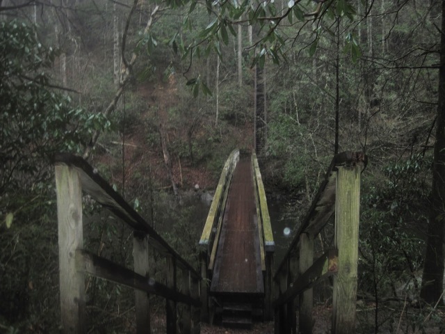
| One of the final – and most uniquie – bridges before we started ascending out of Laurel Valley. |
Motivation had given way to a march to beat the coming sunset as we tried to wring everything we could out of the remaining daylight. If we had seen a decent spot, we probably would have just crashed there, but then the effort of pitching camp didn’t even sound favorable. Falling onto the ground in just a sleeping bag was starting to sound pretty good when I heard a car. Laurel Valley access! We were nearly there! A downhill and then checking the GPS, the trail would come close to Horsepasture Rd. We made it to that point, still had a little light left, and made the call that it would be better to walk a further distance on the flat road than the last heave-ho up and over on the Foothills Trail. Judge me? Whatever.
A quick joke about losing my keys had to come before we opened the car and unloaded gear. Those seats never felt so good, and my shoulders felt so relieved. Chris had been walking on blisters (he suspects a switch to non-SmartWool socks) since Bearcamp Creek the night before, and when I got home, I found that the shoulder straps of my backpack had rubbed my shoulders raw in places. But really, we had one more obstacle – getting Chris’s SUV. We had parked behind the gate at Whitewater Falls, for security reasons. We just didn’t anticipate that we would be the ones kept out. So on the 45-minute shuttle back up to the northwest side of the lake, we just briefly prayed and asked God to have the gate be open. Around 9:00pm on Saturday, we pulled up and the gate was wide open with two other cars there. The skies were cloudless and the stars shone brightly, though we were amazed at how much light pollution still came from Greenville. Though we couldn’t see it, the rushing roar of Whitewater Falls could be heard a short distance away. God had kept us safe as we did things out of uncharacteristic bravado (though we were feeling more exhaustion and humility once we got to our cars). We learned things we shouldn’t do, and were surprised by things that we did do. Would I do it again? As I drove home that night, I said no way in Gehenna. Now, I say, maybe…but at a lesser pace where I can really enjoy my surroundings. I allowed my “having to get things done” to cloud my judgment, though I don’t necessarily regret leaving the way we did. It was good Type 2 fun.
Pulling the data from my GPS and FitBit with the help of overlaying the track on GoogleEarth, it looks like it took 94,534 steps to walk 32.5miles. Based on distance and my base weight only, and not accounting for elevation or the extra 30.6lbs of backpack, I burned 9,656 calories.
 |
| GPS track overlay of our hike on Google Earth with elevation profile. |


